“Gap maps” are the latest technology when it comes to organizing data. Although they aren’t like traditional maps, they can help people navigate through dense resources of information and show scientists the unexplored areas of research.
A ‘gap map’ comparing conservation interventions and outcomes in tropical mangrove habitats around the world turns out to be a beautiful thing.
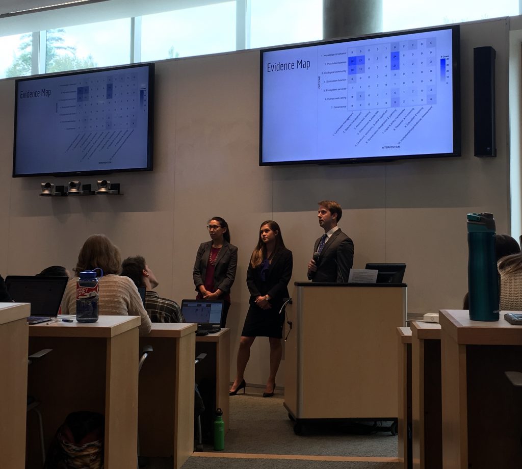
At Duke’s 2019 Master’s Projects Spring Symposium, Willa Brooks, Amy Manz, and Colyer Woolston presented the results of their year-long Masters Project to create this map.
You’d never know by looking at the simple, polished grid of information that it took 29 Ph.D. students, master’s students and undergraduates nearly a full year to create it. As a member of the Bass Connections team that has been helping to support this research, I can testify that gap maps take a lot of time and effort — but they’re worth it.
When designing a research question, it’s important to recognize what is already known, so that you can clearly visualize and target the gaps in the knowledge.
But sifting through thousands of papers on tropical mangroves to find the one study you are looking for can be incredible overwhelming and time-intensive. This is purpose of a gap map: to neatly organize existing research into a comprehensive grid, effectively shining a light on the areas where research is lacking, and highlighting patterns in areas where the research exists.
In partnership with World Wildlife Fund, Willa, Amy, and Colyer’s team has been working under the direction of Nicholas School of the Environment professors Lisa Campbell and Brian Silliman to screen the abstracts of over 10,000 articles, 779 of which ended up being singled out for a second round of full-text screening. In the first round, we were looking for very specific inclusion criteria, and in the second, we were extracting data from each study to identify the outcomes of conservation interventions in tropical mangrove, seagrass, and coral reef habitats around the world.
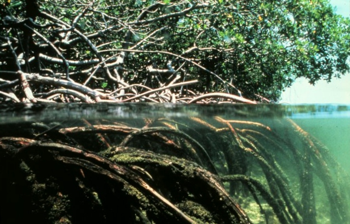
While the overall project looked at all three habitats, Willa, Amy, and Colyer’s Master’s Project focused specifically on mangroves, which are salt-tolerant shrubs that grow along the coast in tropical and subtropical regions. These shrubs provide a rich nursery habitat to a diverse group of birds and aquatic species, and promote the stability of coastlines by trapping sediment runoff in their roots. However, mangrove forests are in dramatic decline.
According to World Wildlife Fund, 35 percent of mangrove ecosystems in the world are already gone. Those that remain are facing intense pressure from threats like forest clearing, overharvesting, overfishing, pollution, climate change, and human destruction of coral reefs. Now more than ever, it is so important to study the conservation of these habitats, and implement solutions that will save these coastal forests and all the life they support. The hope is that our gap map will help point future researchers towards these solutions, and aid in the fight to save the mangroves.
This year’s team built a gap map that successfully mapped linkages between interventions and outcomes, indicating which areas are lacking in research. However, the gap map is limited because it does not show the strength or nature of these relationships. Next year, another Bass Connections team will tackle this challenge of analyzing the results, and further explore the realm of tropical conservation research.