
By Duncan Dodson
Imagine learning research methods while also getting charged by a rhino, observing a pride of lions hunting warthogs, and glimpsing a cheetah and her cub.
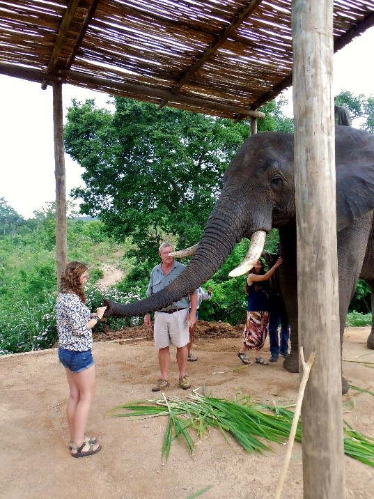
Lizzie feeding an elephant in Kruger National Park in South Africa. Her research attempted to map woody tree coverage in a section of the park since rising elephant populations has resulted in the destruction of woody trees.
Elizabeth “Lizzie” Hoerauf experienced this last summer with five other students from Yale, Vanderbilt, Duke, and Reed Universities. The Organization for Tropical Studies (OTS) brought them to Kruger National Park in South Africa, charging them with researching various plants and animals in the park — with a primary focus on the effects of the park’s growing elephant population.
Culling of elephants – i.e., reducing their populations by selective slaughter — has been banned since 1994, resulting in a significant increase in the elephant population. This seems admirable, yet as the increasingly abundant massive animals roam the savanna they knock down more trees. Fewer trees across the park means lower habitat diversity for the park’s other plants and animals.
Lizzie’s project laid the groundwork for other students’ surveying efforts. To map woody cover, Lizzie took overhead images from previous park data of one of the four supersites that make up the park and overlaid them using Geographic Information Systems (GIS) software.
Her project did not come without its struggles. One moment she would emerge from her tent with a look of triumph telling her peers, “Guys look how amazing this is!” The next, disgruntled and lamenting, “Everything crashed….” However, her ultimately successful data consolidation demonstrated that less than ten percent of the area she studied was now populated with tall trees — a significant decrease from years past.
With some time to reflect Lizzie says that she learned more from this project than in the classroom. When I asked her if she had interests in returning to project in the future she noted a preference to pursue field research projects of her own. Lizzie did let me know that OTS is a wonderful program that Duke offers — it felt rewarding to be a small part of a massive and constantly evolving field research project.

Using Geographic Information Systems (GIS) software, Lizzie was able to map out and analyze woody tree cover for one of the supersites of the park. Her analysis found approximately 6 percent of the supersite to be covered by tall trees, much lower than previous years (12 percent in 1940 or 9 percent in 1974).